


Tracks of time: Nelson's Railway Reserve history
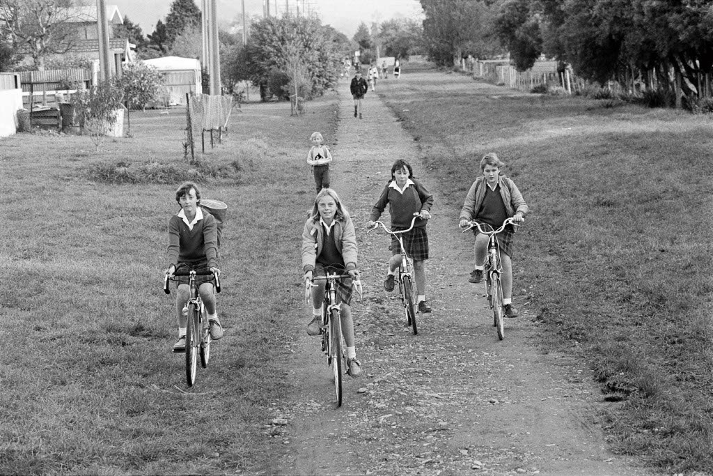
Broadgreen Intermediate students Rachel Tucker, Fiona Colvin, Katrina Valentine and Janine Woodhouse.
Nelson’s Railway Reserve is a stunning 8km cycle/walking path stretching from the Coastal Highway in Stoke to Victory in Nelson City.
In this article, Our Nelson takes a look at how it went from a rough, gravel-covered active train line to a smooth, sealed active transport corridor.
“The section between Stoke and Victory was still gravel until 2009,” recalls Rebecca Dawkins, Council’s Manager Capital Projects.
“It was one of my first projects when I started at Nelson City Council as a cadet in Capital Projects. I was the young one sent out to spend my days in the hot sun surveying in the orange orchards that lined the route at the time. The Railway Reserve we have today didn’t even start to take shape ‘till the late 90s.”
It was once called the “Nelson Section”, a government-owned railway line running from Port Nelson through Hampden Street, Bishopdale and Stoke continuing all the way to Glenhope in Tasman District. It was a railway that was considered crucial to the development of the Nelson province.
The last train along the Nelson Section ran on 2 September 1955 and the railway infrastructure was removed shortly afterwards. Aerial views from the 1960s show the railway as a rough, stone-covered track carved out of the hillside. Although Council purchased sections of the old railway line in the 1960s, development didn’t start until the mid-80s.
“We nearly lost parts of the Railway Reserve in the 1990s when NZ Railways, hard up for cash, proposed selling it off in sections to neighboring property owners,” says Nelson Mayor Nick Smith. “Council reserves staff contacted me, then as the local MP, to intervene and thankfully, we were able to persuade the government to vest the reserve with Council.”
Council’s Works and Energy Committee met on 5 May 1986 following the tragic death of a schoolgirl cyclist.
The committee members considered a proposal to form a 2m-wide unsealed cycle track along the Railway Reserve from Poorman Valley Stream to Annesbrook Drive. The reserve was then designated as a cycleway in an effort to get school students commuting to and from school, off the road. Approval of the $18,000 budget was a poignant moment for Councillor Mel Courtney.
Mel's grandfather was a train driver on the Nelson Section who drove the route between Nelson and Glenhope. Nearly 65 years later, Mel was Chair of the Finance Committee that oversaw the feasibility of marshalling funds for the development of the Railway Reserve.
“The Railway Reserve cycleway/walkway was a visionary project ahead of its time. It was a necessary response to the economic conditions of 40 years ago when fewer families could afford a motor vehicle. The project provided people with the freedom and essential means of transportation,” says Mel.
“Using the Railway Reserve as a cycleway was a great use of what was then a little-used corridor, but, above all else, improving the safety of vulnerable cyclists and pedestrians.”
Later that month, Council was advised that Shell Oil would be contributing a “generous donation” of $500 towards signposting for the cycleway. Councillor Derek Shaw commented that it was only through donations such as Shell Oil’s that Council was able to provide for the cycleway that financial year. The project was further aided by a substantial donation in machine time by contractor Andy Whiting.
The cycleway proved immediately popular. Council’s Works Engineer Dave Faulkner received complaints about the surface of the pathway being unsatisfactory, with excited users not realising that the work was unfinished. However, it would be years before it was sealed.
Broadgreen Intermediate students Rachel Tucker, Fiona Colvin, Katrina Valentine and Janine Woodhouse were some of the first to use the Railway Reserve. While Janine Woodhouse, now Janine Craig, doesn’t recall the first time she used the reserve, she has fond memories.
“I grew up on Annesbrook Drive, so the Railway Reserve was a big part of our lives. It was great to be able to bike or walk along the reserve to get to school, keeping off the main road. I also used to go to Riding for the Disabled and we used to ride the horses along the Railway Reserve."
"Eighty years ago, trains carried them to school, with one carriage for Nelson Boys College and another for Nelson Girls College. Today, it's the same route, now travelled by bike" - Councillor Mel Courtney
It would be another decade until the reserve was connected between Stoke and Nelson. Council undertook a “Safe Journey to School” survey for Victory School and Nelson Intermediate in the early ‘90s, at which stage the adjacent reserve was still unsealed and overgrown. The feedback was that students and their families were reluctant to use it for a variety of reasons including because it was muddy, and they were feeling unsafe.
In 1995, the Traffic Design Group presented a report on demand/location of cycle routes. This report recommended improvements to the Railway Reserve from Songer Street through to Vanguard Street.
Work started in 1996 to upgrade the section behind Nelson Intermediate and Victory Primary including vegetation and drainage resulting in an immediate increase of users.
While the reserve was almost at full length and designated as a cycleway, it wouldn’t be sealed till the late 1990s. It was little more than a dirt track, with residents who backed on to the reserve growing vegetables on the land.
“Sections of the reserve ran through land owned by farmers. When we started this section in 1999, most of what would become the Railway Reserve between Songer Street and Saxton Road was all orchards. Council had to negotiate the purchase of this land from the farmers,” says Rebecca.
In 1999, the Saxton Road West to Quarantine Road was completed, along with connections to Whakatu Drive, Main Road Stoke and Elms Street. That year also saw the completion of the connection to Beatson Road. This work was done alongside the Whakatu Drive State Highway works and over bridges.
Further works were carried out between 2004 and 2009 including and extension from Saxton Road West to Orphanage Creek, the Jenkins Path link and paving the section from Beatson Road to St Vincent Street.
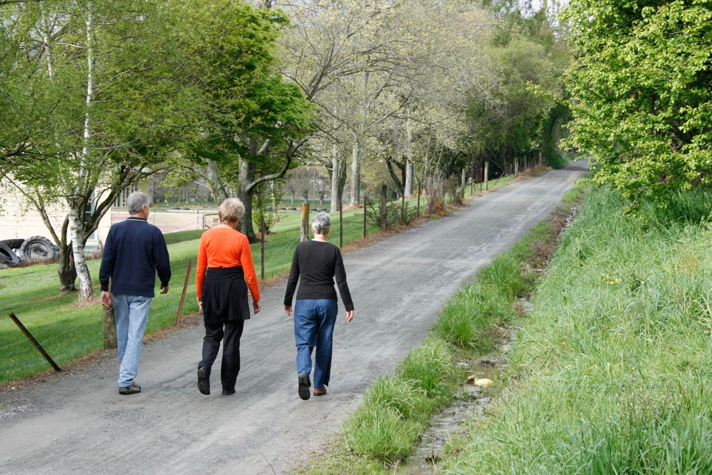
2008: Walkers on the Victory section of Railway Reserve before it was sealed
The purchase of land from farmers wasn’t the only complication in the development of the Railway Reserve.
“While planning for Clarence Drive and the underpass in Bishopdale, a number of historical culverts were discovered,” says Rebecca.
Archaeological site records indicated these were part of water control systems from the 1870s. These were the only known examples of this style of headwalls and pipes in New Zealand, so it was important to preserve their archeological heritage.
The result was a concrete barrier surrounded by retaining walls.
“Whenever I see a mountain biker use them as a jump, I have a wee giggle to myself. They have no idea the significance of what they’re jumping over,” says Rebecca.
These culverts were not the only historical find.
“There’s a gated vehicle entrance off Songer Street, and another off Saxton Road West. The gates were restored from the old railway, they would’ve been used to keep livestock from entering the rail line,” says Rebecca.
The most recent upgrade to the Railway Reserve was the $1.9 million lighting project. Covering 95% of the Railway Reserve, the lighting project was advocated for by the Nelson Youth Council, NELSUST and cycling advocates.
In 2025, the Railway Reserve has transformed beyond recognition from its days as a working railway.
“It’s worth noting that although the route has been transformed from a railway into a cycle path, not much has changed,” says Mel. “It has long been popular with secondary school students – 80 years ago, trains carried them to school, with one carriage for Nelson Boys College and another for Nelson Girls College. Today, it's the same route, now travelled by bike.”
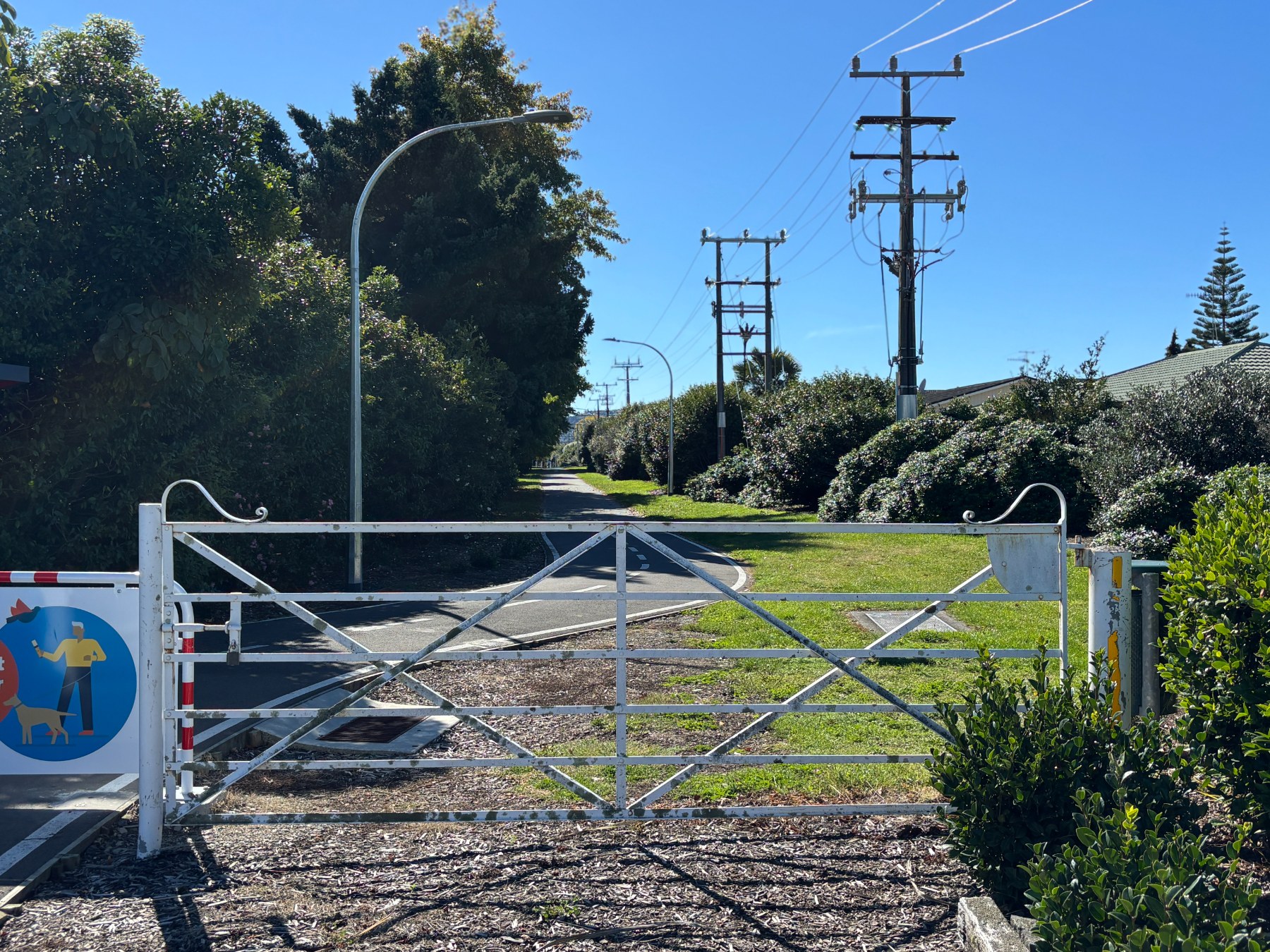
Restored livestock gates on Songer Street
