Spring 2026 climate outlook and El Niño preparedness
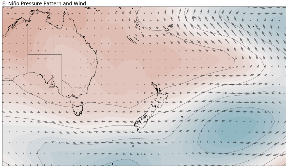
El Niño is a natural climate pattern that starts thousands of kilometres away, in the tropical Pacific. Normally, trade winds push warm surface water westward, so it piles up around Indonesia and northern Australia. Sea levels there sit around 60 centimetres higher than off the coast of South America.
When those trade winds weaken, that built-up warm water surges back east across the Pacific. It takes two to three months to cross the ocean, and as it moves, it shifts rainfall and storm patterns and changes weather far beyond the tropics, including here in Aotearoa.
For Nelson, one of the flow-on effects is more frequent and sometimes stronger westerly winds, particularly into spring and over summer.
The winter connection: why moisture matters
A defining challenge for spring 2026 is the legacy of a dry winter. Many regions entered the season with reduced groundwater recharge after below-normal winter rainfall. Because the environmental 'bank account' of water was not topped up over the colder months, predicted spring dry spells and enhanced evaporation will place immediate and severe pressure on soil moisture and river levels.
Climate drivers and expected local impacts
Climate driver
| Expected local impact
|
|---|
Intensifying El Niño (very strong)
| More frequent, unusually strong westerly and southwesterly wind spells.
|
Record subsurface warming
| Provides the energy for the event to peak as a top-tier historical climate shift.
|
Marine heatwaves (South Island)
| Likely to moderate some cold outbreaks, though local variability remains high.
|
Reduced winter recharge
| Accelerates drying of soils and vegetation, increasing stress on water-reliant sectors.
|
Because the atmosphere is behaving in a highly predictable El Niño configuration, risk diverges clearly: the north and east face moisture deficits, while the south and west must prepare for hydrologic extremes.
Nelson's climate zone: variable and windy
ZONE 2 — VARIABLE & WINDY
Central North Island, Taranaki, Whanganui, Manawatū, Wellington, Tasman, Nelson, Marlborough, Buller, Canterbury, East Otago.
Read more on the Seasonal Climate Outlook from NIWA: https://niwa.co.nz/climate-and-weather/seasonal-cl...
Temperature
| High variability is the defining feature. Equally likely to be near or above average, with large swings between hot and cold and spells of unusually windy weather.
|
Rainfall
| Likely to be near normal to below normal across the season.
|
Water & soil
| Wind intensity dominates — accelerating vegetation drying and risking rapid soil moisture loss in the rain-shadow of the main ranges.
|
Community preparation
To support resilience through this historically significant El Niño, the Nelson region has been advised to prepare for the following:
Water conservation & fire safety
Target: dry and variable zones
- Monitor soil moisture early. Low winter recharge means vegetation reaches a stress point faster. Check plant health regularly.
- Mitigate fire risk. With enhanced drying of vegetation and high winds forecast, clear gutters and maintain defensible space around structures.
- Use water efficiently. Implement water-saving protocols now — river flows are about equally likely to be below normal (45%) or near normal (40%), so margins are thin.
- Plan for warm spells. Sudden temperature spikes can rapidly deplete remaining surface water.